Cosmic Calendar

We sapiens think so highly of ourselves. Yet we’ve been here for such a ridiculously short period. And something like writing is not even a blink of an eye.

February

Astronomer Carl Sagan described the history of the universe in a one (earth) year calendar. The big bang occurred at midnight January 1st, with the basic elements created in the first three seconds. It took until February for the oldest stars and galaxies to begin to form.

March

Around mid-March our Milky Way began to form.

September 9

Our solar system was starting its formation around September 9th.

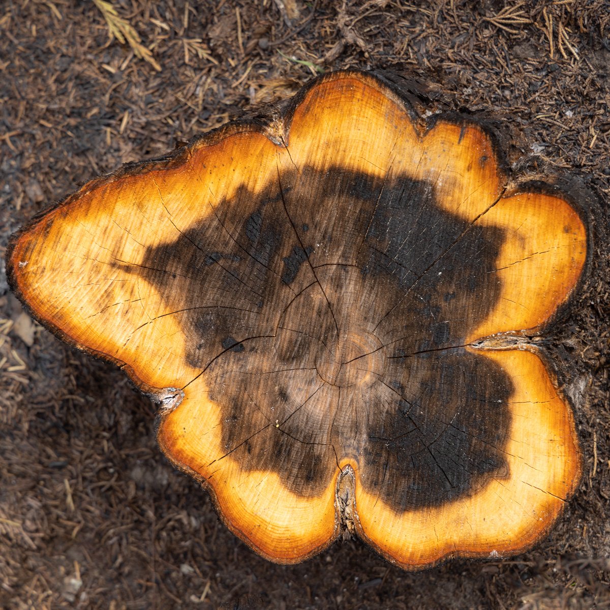
So what wisdom resides within these rocks and simple elements? How might we tap into that? A hummingbird sees different light wave lengths than we do, and the speed at which the bird travels might be perceiving a different shape of the world. Might a centuries old tree sense time and the environment around it in ways beyond our imagining?

September 14

Earth began to take shape a few days later, and perhaps only ten days more, the very first simple life forms started.

These images are from Reynisdrangar beach near the village of Vik, Iceland. Vik means Viking, and they had a legend that the three-masted troll ship you see in the back ran aground here. Iceland is new land on this planet. As the European and North American continents pull apart, right here lava flows up. After millennia of erosion, these basalt formations take shape. A camera can lengthen time a bit, and let us see the sea dancing and playing with these rocks—eroding and shaping them and pushing the black sand to the shore.

December 20

Around December 20th, plants began to take root on the Earth. Four days later and for five days, dinosaurs spread in the sea and on land.

December 31, late in the day

About 10:30 p.m. the first humans appeared. At 11:59:51, the alphabet was created. Buddha and Jesus were born about 400th of a second later. Around 11:59:58 some of those Vik Vikings might’ve made their way to the North American continent.

Skaftafell National Park

We’ve had nearly a week here of temperatures below freezing, and several more days to that to come. So it’s appropriate to think of a place called Iceland. Skaftafell National Park sits between the ocean to the south and the giant Vatnajökull glacier to the north. In the park, you can hike up the mountain for a view of a giant tongue of that glacier breaking through the mountain and working its way to the sea.

Skaftafellsjökull

Jökull is Icelandic for “glacier,” so I suspect you can figure what Skaftafellsjökull means. Here’s the view south from the same vantage looking as the glacier moves toward the ocean. I trust you can spot my son Dan.

Skaftafellsjökull

If you look at the highest point of the top of the mountain on the other side of the glacier, you can imagine piecing the two images together to get a sense of the full view. And here’s a switch from the wide angle lens to the telephoto to get a closer view of that peak.

The three mile loop trail continues away from the glacier view to several waterfalls that come down the mountain. Oh, and the Icelandic word for waterfall is foss. So here’s one of the more dramatic—Svartifoss. You can see it carving through the columnar basalt created as the lava cooled.

And I just checked the weather report. Yep, colder here today in Northern Illinois than Iceland.

Svartifoss

Epiphany

Marriam-Webster:

a(1): a usually sudden manifestation or perception of the essential nature or meaning of something

(2): an intuitive grasp of reality through something (such as an event) usually simple and striking

(3): an illuminating discovery, realization, or disclosure

b: a revealing scene or moment

St. James Farm Forest Preserve, DuPage County

Marriam-Webster:

capitalized : January 6 observed as a church festival in commemoration of the coming of the Magi as the first manifestation of Christ to the Gentiles or in the Eastern Church in commemoration of the baptism of Christ

St. James Farm Forest Preserve

To celebrate Epiphany, our community sang a song written in 1857: We Three Kings of Orient Are. John Hopkins’ verse is definitely mid-nineteenth century turgidity. (Marriam-Webster: Turgidity: excessively embellished in style or language) Then it ends in a wonderful last verse: “Alleluia, Alleluia” sounds through the earth and skies.

Blackwell Forest Preserve, DuPage County

How to be attuned to the Alleluia that sounds through the earth and skies? It is always there, and most everywhere. But winter storms in a forest let it resound.

St. James Forest Preserve

And sometimes a friend stops to say: “Look here.”

Herrick Lake Forest Preserve

So let’s look closer.

Herrick Lake Forest Preserve, DuPage County

In 1914, following urging by landscape architect Jens Jenson, and urban planner Daniel Burnham, the voters of Cook County established the first forest preserve in the country. The next year, neighboring DuPage County, where all these images are taken, voted to create forest preserves there. The following year, Congress created the National Park Service. All places to hear the Alleluias.

Herrick Lake Forest Preserve

Walking in the woods was like being in a snow globe.

Herrick Lake Forest Preserve

Epiphany was celebrated as a holiday even before Christmas. Eventually, the church set Christmas Day as December 25 and Epiphany as January 6. Epiphany Eve was called the Twelfth Night. This winter we saw a wonderful production of Shakespeare’s Twelfth Night. It starts: If music be the food of love, play on.

Herrick Lake Forest Preserve

Father and son Ben and David Crystal have just published a new book—Everyday Shakespeare: Lines for Life. They have a theme for each month, a quote for each day, and some commentary. For March 26th, they have a line from Twelfth Night, and provide this context: “The sea captain Antonio has been arrested for setting foot in Illyria. He asks the disguised Viola for help, supposing her to be his friend Sebastian (who turns out to be Viola’s lost twin brother) . . . When he/she refuses, Antonio is distraught, and harangues him/her for being so shameful.”

In Nature, there’s no blemish but the mind,

None can be called deformed, but the unkind.

And the Crystals comment: “Perhaps the only blemish (“fault”) in life is the way we think, or the way we treat each other. Be kind. (Especially to yourself.)

St. James Farm

Nebraska

The last large state to cross on the return of my fall trip was Nebraska. I started in the southwest part of the state crossing over from Colorado. The autumn colors were still strong, though not the aspen and cottonwoods. Definitely on the plains.

Not many animals to see except for a variety of raptors searching the rolling land for prey I could not see.

After visiting Scots Bluff, I continued north to another National Monument—Agate Fossil Beds. Near the end of the 19th century, James and Kate Cook found fossil bones on a hill on their ranch. It became the largest collection of giant Miocene mammals ever found.

Agate Fossil Beds National Monument, Nebraska

While there’s not much to explore on the land of the monument, the visitor center museum displays a phenomenal collection of the fossils. But that’s only half of the amazing collection. The Cooks became trusted friends of the Lakota who gifted them with many artifacts including a buffalo hide with the story of the Battle of Greasy Grass a/k/a Little Bighorn.

Chief Red Cloud was a good friend and Lakota and Cheyenne would visit the Cooks filling the surrounding lands with their tepees. You need to image them and the bison today.

After camping in Nebraska National Forest (yes, it surprised me, too, that there was a forest in Nebraska), I awoke to a land covered in fog.

The sandhills along the Niobrara River had a special beauty as I travelled the entire length of the state in fog.

A few cottonwoods appeared out of the mist.

It was a quiet, peaceful end to the trip as I headed eastward, home.

Capulin Volcano

A gift of travel is finding spots on maps that grow and come alive. As I planned earlier trips to the area, Capulin Volcano National Monument hung up on the northwest corner of the map of New Mexico just south of Colorado. I kept looking at the spot, and wanted to visit, but the logistics just did not work out on prior trips. On this trip it would be the final stop before leaving New Mexico.

Capulin Volcano

Approaching from the south in the morning, you can see the road that winds up the cinder cone. The road ends on the little bright spot on the top left. From there, you can hike a mile around the top ridge or head down into the crater.

Capulin Volcano crater

By finally scheduling a stop here, I was lucky to arrive at peak autumn color at the end of October. Looking down to the lava flow plateau below the rim trail, the clusters of fall color popped out. Capulin erupted about 60,000 years ago, so enough time has elapsed for soil to level the ground and plants to grow.

And more color erupts right at your feet.

The pinyon pine is the state tree of New Mexico. This one on the rim likely gave lots of nourishing nuts to birds, squirrels and deer over its life. It now provides some drama to the view.

In all directions from the rim, a smooth plateau of old lava flows extend to more distant cones and shield volcanos. All the dots on the map came alive.

Badlands on the Divide

El Malpais National Monument is tucked into the northwest corner of New Mexico. My faster travels the day before and a full campground where I planned to stay had me arriving here a day early. Unlike most national park sites, El Malpais (spanish for the Badlands) allows dispersed camping (i.e., not in a designated campground, a/k/a boondocking.) Heading down a backroad, I found a spot for the night on the edge of the lava field right along the Continental Divide.

El Malpais National Monument, New Mexico

In the image above, you can see some of the cinder cones in the distance as well as the lava that makes up much of the monument. I didn’t have time to do much hiking in the park, but amazingly an ancient trail crosses the lava field near here. Call the Zuni-Acoma trail, it has been used for generations by the Zuni and Acoma tribes on either side of the barren land as a trade connection between the peoples.

The volcanic activity here is due to the thin crust since the center of New Mexico is split by the Rio Grand Rift Valley, one of only four major rift valleys in the world. I wrote about (the confusingly named) Malpias Lava flow a couple weeks ago, and about the massive Valles Caldera while I was traveling. I hope to post about Capulin Volcano soon.

Bosque del Apache National Wildlife Refuge lies along the Rio Grande. The river runs mostly north-south through the center of the state where the continent is ripping apart. Slowly.

The oldest of the five major lava flows at El Malpias NM was over 1115,000 years ago. The most recent is only a couple few thousand years old, certainly within the oral traditions of the indigenous peoples who live nearby. Where I camped, the lava flow was near more forested land that led up to nearby mountains. A golden sunset led to a peaceful night filled with stars.

The National Monument is mostly surrounded by BLM-protected land named El Malpais National Conservation Area. Sandstone features are throughout the area where lava has not covered. I went to see one of those features called La Ventana Natural Arch. As the sun began to peek over the arch, I chatted with a fellow whose trail name is Blacklight. He was heading to the Mexico border hiking the Continental Divide Trail from Canada to complete the Triple Crown of Thru-Hiking. In earlier years, he had completed the Appalachian and Pacific Crest trails. His work leave-of-absence was ending and he’d need to decide whether to continue this lifestyle or return to software engineering. Life on the Divide.

La Ventana Arch, El Malpias National Conservation Area, New Mexico

A to Z -- Annular to Syzygy

In 2017, I viewed my first total solar eclipse in Shawnee National Forest in Southern Illinois. On April 8, 2024, the next total solar eclipse will track from Texas to New York, and the place the path will cross the 2017 eclipse is Shawnee NF. I plan to go back to the same spot. While doing some planning for that trip, I discovered there would be an annular solar eclipse in October 2023 tracking from Oregon through Texas. Unlike a total eclipse, in an annular the moon is too far away from earth to completely cover the sun. What results is often called a “ring of fire” as the edges of the sun shine around the moon. Seeing that seemed like a good excuse to plan a trip back to the Four Corners which would be right on path of the eclipse.

Sunrise Kansas

To view an eclipse, of course, you want clear skies, and I hoped the desert southwest would deliver such weather. My first sunrise in Kansas on the drive west was a good omen.

I’d be staying in the Navajo Nation for the event. Many Navajo believe it is bad fortune to be outside during an eclipse. Some places, such as Monument Valley, would be closed to visitors. As I wrote in this week’s Tuesday Travel post, I decided to go to a remote area called Lower Butler Wash in Bears Ears National Monument. Turned out, many people had the same idea. My second night camping in the wash, there were seven other vehicles around me—more than I’d seen on entire day on my prior visit. Many more were parked up and down the washboard road.

Campsite near Comb Ridge

The day before the eclipse, after the hikes I wrote about in Tuesday’s post, I drove the sandy, slick rock, rutted road out to the highway to see some other petroglyphs and to go to the small town of Bluff. Some Navajo were taking advantage of having so many people visiting and had set up some cooking tents. Pork on Indian Fry Bread and a hatch chile was a clear invite that I would not need to cook dinner.

Driving back to Comb Ridge, I began thinking that I might leave the area the next morning before the eclipse since it would not be the isolated location I planned, and I’d not found a place I wanted to use as a foreground for images during the event. On my turn of the highway down Lower Butler Wash Road, I saw three motorcycles in my rearview mirror, and decided I’d let them go ahead since they’d likely navigate the rough road faster than my SUV. As they passed, I thought, “These guys are quite a bit older than me, and wow, I didn’t think you could get that much gear on a motorcycle.” A bit down the road, one of the cyclists stopped at the top of a hill while the other two went down a steep, very sandy drop and I stopped behind him to wait. Soon, boom, boom, both guys tipped and fell with their overloaded bikes on top of them. Neither were hurt, but we had to help lift their bikes off them as they walked the rest of the way down. My decision was made. I was not going to get caught in the inevitable traffic mess that would occur after the eclipse.

Sunrise on Butler Wash Road

Despite a questionable forecast, Saturday morning did not have a cloud in the sky. Shortly after the sun cleared the eastern ridge, I headed south. Butler Wash empties into the San Juan River, a major tributary of the Colorado. I read there were some ancestral homes and petroglyphs on the south side of the river, so I scouted there to find them and watch the eclipse.

Composite image of annular eclipse, Navajo Nation

In this space, Chance and I were the only ones around to watch the event. (We never did find any ruins, though we did see some old Navajo hogans.) In the image above, the trees grow along the San Juan River in front of us. The sun was actually behind us, but there were no close features to picture there since the sun was high in the sky. The composite helps see the event and the location. In the image, the eclipse started with the lower left image of the sun as the moon dropped in from the top and continued its journey across the face of the star. In the top right image, the moon is exiting its transit.

Syzygy

Although Chance and I and some Navajo horses were the only ones in the area, there was a campground on the north side of the San Juan. When the moon covered the sun, a cheer carried across the river. Somewhere else in the distance some drums began to beat. While it didn’t get dark as in a total eclipse, instead of clear-sky, mid-day desert light, the landscape looked as if night would descend soon. If you saw my Tuesday post of a petroglyph on the other side of the San Juan, the creator of that image 1,200 years ago created something that looked like the annular eclipse. It possibly meant This is one of those places.

I took many images when the moon just transited the edges of the sun. I’d read that you might get an effect of a ray or starburst as sunlight travelled through a mountain or crater on the moon. That didn’t happened, but you can see the rough bit of light on the moon’s south pole where some features are blocking the light near where the Indian Vikram lunar lander explored a couple months earlier.

If you’re anywhere near the path of totality in April, I’d encourage you to hope for clear skies and witness the event. For that, the moon will be much closer to the earth, covering the sun for a relatively long time. Also, this is a period of great solar activity, so there may be a big corona to view.

I thought the solar show was over, but a week later I got another solar ring. Planning this trip, I discovered that the following Saturday, the Trinity Site where the first nuclear bomb was tested, would be open to the public. It’s only open two days a year. More on that visit later, but as I finished seeing the monument and was returning to the car, I looked up to see two sun dogs on either side of the sun. As I walk on, an entire halo circled the sun. People were walking back-and-forth oblivious to the sky show. I stopped to some to say, “look at that!” Then, a cloud formed from a passing jet pierced the sun. This is one of those places.

Thankful

My prior visits to New Mexico had always included incredible sunrises or sunsets. This trip had mostly clear skies—which was perfect for the day of the eclipse—and days with clouds just had nice, but not spectacular displays. One event the trip was planned around was the twice-a-year Saturday that the Trinity Site would be open to the public. I wanted to camp close by, so I could get in line before sunrise. I choose to camp at a Bureau of Land Management site I’d hiked at on prior trips to the area. A meteor shower was predicted for the night, so clear skies would be great.

Valley of Fires Recreation Area

The area is the northern part of the Tularosa Basin, and here about 5,000 years ago, the Malpais Lava Flow covered the basin. Today, yucca, sotols, cactus and other desert plants grow within the lava rock. Following a hike through a trail cut among the lava, we returned to our camping spot where we had a high look out behind us. Lots of clouds began to move in. Would they cover the sun, or would the Valley of Fires have a blazing sky?

The sun set with nice golden color behind the distant San Andres Mountains. Another photographer had come for some images and left. But sometimes the best color arrives well after the sun goes down. We sat among the rocks to enjoy the changes.

And we were rewarded for the show. The next morning we’d be on the other side of the first ridge of mountains where the Trinity Site was the test for the first atomic bomb in 1945.

The show was mostly done. Time for the flashlight to help get back to camp. The clouds would block the meteor shower for that night, but the sunset was a terrific exchange to miss that sky show.

Colorado Road Color

As autumn color is fading here, it’s time to remember the surprise of brilliant colors as I drove across the Rockies in Colorado last month. I had a couple planned stops at national park sites before getting to the western part of the state but mainly just planned driving across the state. The drive took quite a bit longer than planned because the breathtaking aspen and cottonwood leaves demanded many stops.

Ranch near Pike National Forest, Colorado

Not far from Florissant Fossil Beds National Monument, horses were feeding in a meadow surrounded by cottonwood with aspen adding color to the mountain forests.

Pike National Forest

Climbing further into the mountains, more aspen were surrounding the pines and firs.

Leopard Creek

A few weeks ago, I posted some images from Curecanti National Recreation Area. Heading further west the next morning continued the incredible displays of color.

Uncompahgre National Forest

Not far from the ski resort town of Telluride, the road goes over passes well over 11,000 feet. As I lined up some images of the distant peaks, Chance was helpful enough to jump up and pose.

Trout Lake, Uncompahgre National Forest

As you can see, you can’t get very far before the scenes demand you pull over again to take in the view.

Beaver Lakes along the Delores River

The mountain scenery would very soon end, and we would be in the high desert of the Colorado Plateau. So one last stop to hike along the beaver ponds that followed the Delores River. The planned sites were wonderful to see, but the unexpected scenery enriched the trip greatly.

Just like the white wing dove - Bosque del Apache

On October 21, I would be visiting the Trinity Site where the first nuclear explosion test was conducted in 1945. I’d be lining up long before sunrise because the site is only open to the public two days a year, and the army warned that the because of the Oppenheimer movie, they expected larger than normal crowds. The sunrise the day before, I visited on of my favorite places—Bosque del Apache National Wildlife Refuge, New Mexico.

Dawn—Blackbirds at Bosque del Apache

The White Stallion Army base is on the other side of this mountain range. In late November, thousands of Snow Geese, Sandhill Cranes and other birds fill the Rio Grande River wetlands in the Bosque. A few of the cranes were just arriving when I visited last month.

Sandhill Cranes

Well, I went today

Maybe I will go again tomorrow

Yeah yeah, well the music there

Well, it was hauntingly familiar

Well, I see you doing what I try to do for me

With the words from a poet and a voice from a choir

And a melody, and nothing else mattered

Stevie Nicks, Edge of Seventeen

Until I searched for lyrics from this song to add to this post, I had no idea who Stevie Nicks was referring to in that verse: John Lennon and her uncle John. They both died in the same week in December 1980. She was with her uncle when he died. She said later: “The part that says ‘I went today… maybe I will go again… tomorrow’ refers to seeing him the day before he died. He was home and my aunt had some music softly playing, and it was a perfect place for the spirit to go away.”

The reference to the poet and voice from a choir was to the murdered John Lennon who was a friend of her boyfriend at the time, who she was comforting while she was suffering from her uncle’s death.

Sunrise cottonwood and blackbirds

Just like the white winged dove
Sings a song, sounds like she's singing
Ooh, ooh, ooh
Just like the white winged dove
Sings a song, sounds like she's singing
Ooh, baby, ooh, said ooh

And the days go by, like a strand in the wind
In the web that is my own, I begin again
Said to my friend, baby (everything stopped)
Nothin' else mattered

Stevie Nicks, Edge of Seventeen

Lots of Mourning Doves where ever I’ve lived, and plenty of Turtle Doves where I grew up in Florida, but White-Winged Doves are birds of the desert southwest. When I first saw one only a few years ago and each time I do, Stevie Nicks’ voice sings in my ear of the the white winged dove.

“It became a song about violent death, which was very scary to me because at that point no one in my family had died,” said Nicks elaborating on the meaning of the line. “To me, the white-winged dove was for John Lennon the dove of peace, and for my uncle, it was the white-winged dove who lives in the saguaro cactus—that’s how I found out about the white-winged dove, and it does make a sound like ‘whooo, whooo, whooo.’ I read that somewhere in Phoenix and thought I would use that in this song.”

White-winged Dove - Bosque del Apache NWR, New Mexico

Navajo Nation - Canyon de Chelly

In northeast Arizona in the center of the Navajo Nation (the biggest Indian reservation which is larger than the state of Wisconsin) is Canyon de Chelly (d’SHAY). The canyon has been continuously occupied for nearly 5,000 years. As they have for centuries, the doors of the Navajo homes and hogans that fill the area face east for the rising sun.

Canyon de Chelly sunrise

When Canyon de Chelly National Monument was established in 1931, the presidential proclamation stipulated “the grazing and other rights of the Indians are in no way interfered with.” The park is jointly managed by the National Park Service and the Navajo Nation Parks and Recreation. Roads with viewpoints run along the north and south rims of canyon. Looking down, you might see faces of the ancestors as well as their buildings.

Mummy Cave, Canyon del Muerto

The largest of the Ancestral Puebloan dwellings is the 80 room Mummy Cave dwellings 300 feet up from the valley floor. In 1882, two mummified bodies where found here giving its present name. Zooming in, you can see the wood beams and some of the plaster still on the walls after being vacated over 700 years ago.

Mummy Cave dwellings

A special feature of the park is seeing the Navajo homes amongst those of the Ancestral Puebloans. Some say the Navajo came to the area only a few hundred years ago from further northwest. But a couple of the Navajo I spoke with definitely consider the people who lived here their ancestors. Anasazi is a term that has fallen out of favor to describe the people who inhabited the area a thousand years ago. Some say the term is Navajo for “ancient enemies”, while others define it as ancestors.

The sandstone in the canyon walls tell stories of the sand dunes and ocean bottoms that flowed here over 200 million years ago, and play in today’s sunlight.

You can only enter the canyon with Navajo guides. But some of the residents set up tables on the rim drive to sell artwork they create. As I type I wear a bracelet from A C Henry with etchings of the four sacred mountains of the Navajo. He also had many works with the plants of the area. The shapes and autumn colors are certainly inspirational.

The final stop on the south rim drive offers a view of the feature I most wanted to see in the park: Spider Rock. The monolith rises 800 feet over the valley. Legend is that Spider Woman or Grandmother lived on top. She was a mythic figure for ancestral natives and is found in petroglyphs, and remains in current oral tradition. She was a protector of the people, taught them how to weave, and of the Beauty Way to balance mind, body, and soul.

And she’d eat misbehaving children, so the white on the rock are the bones of those naughty ones.

Spider Rock, Canyon de Chelly National Monument, Arizona

Who Killed Capt. Gunnison? - October 26, 1853

One of the pleasures of travel is learning stories about our history. There’s also the benefit of seeing surprising, amazing sites along the way.

Gunnison River - Curecanti National Recreation Area

Curecanti National Recreation Area lies just upriver from Black Canyon of the Gunnison River National Park. The Gunnison was dammed in three areas to create reservoirs. The spot in the image above is where the Gunnison River meanders between two of the lakes that were created. On the October day, the wind was blowing the cottonwood leaves nearly horizontally to join the rain coming down in the passing storm while the sun lit up the scene. Pretty amazing.

Curecanti is named after Indian chief Curecanta of the Utes who lived in this rugged area in the Rocky Mountains. Who was John Gunnison that the river, and nearby town of Gunnison, was named for?

Dillon Needles trail, Curecanti National Recreation Area, Colorado

John Gunnison was born in New Hampshire in 1812, and after graduating from West Point, was sent to Florida during the Seminole wars in 1837. However, his poor health led him to be assigned as a surveyor to explore and map the territory of Florida. While that assignment also challenged his health, he caught the exploring bug.

In the 1840s, he was assigned to survey the Northwest Territories, and primarily the western coast of Lake Michigan. Hmm, does my move from Florida to the west coast of Lake Michigan create some affiliation with this guy? Gunnison was promoted to Lieutenant while surveying the border between Wisconsin and Michigan. In 1849, he got a new assignment to explore the Mormon Trail and survey the Great Salt Lake valley. The Latter Day Saints and Paiute Indians were battling, and Gunnison mediated a settlement. One of the groups would kill him in a couple years.

Autumn Cottonwoods in Curecanti National Recreation Area

Once back in Washington, D.C., Gunnison would publish a book he started while in Utah: The Mormons, or Latter Day Saints in the Valley of the Great Salt Lake: A History of their Rise and Progress, Peculiar Doctrines, Present Condition. He then was sent packing to Green Bay to survey more of the Wisconsin area, and earned a promotion to captain. He soon was heading west again to explore a possible route for the newly expanding railroads. He reported that the area in southern Colorado would be too challenging of an area to cross the Rocky Mountains. (The first transcontinental railroads would eventually cross further north and south.) He was one of the first Americans to explore the steepest canyon in the country which would eventually be named for the river to be named after him: The Black Canyon of the Gunnison River.

Storm Clouds above the Gunnison River

The river was then called the Grand. Gunnison described this area south of Black Canyon "the roughest, most hilly and most cut up," he had ever seen. Concluding this would not be an appropriate route for a railroad, he went further north and then west into Utah. On the journey, he found Mormon settlements that had been raided by Paiutes. He again attempted to mediate.

On the morning of October 26, 1853, Gunnison and seven of the eleven men with him were attacked and massacred. Governor Brigham Young said the group was killed by a band of Paiutes seeking revenge for the killing of their leader by a group of emigrants heading west. However, based on letters Gunnison had sent, his widow believed he was killed under the direction of Young who was objecting to a railroad coming to the territory that would bring non-Mormon settlers. An associate U.S. judge in Utah wrote back to her that white settlers dressed as Indians conducted the massacre. The War Department appointed an investigator, who concluded the Utes were responsible and following a trial, three were convicted. However, the massacre increased tension between Young and the U.S. Government, and President Buchannan sent troops to Utah to assert control over the Territory.

Cottonwood and Dillon Pinnacles, Curecanti National Recreation Area

In Curecanti National Recreation Area, above the river named after Captain Gunnison and west of the Colorado city with his name, rise pinnacles being carved into the mesa. On my visit, they and a lone cottonwood glowed in the light of the setting sun as the storm moved east.

Valles Caldera -- Valley of the Senses

At dawn, Chance and I headed down one of the few pet friendly trails at Valles Caldera National Preserve in northern New Mexico. I’m unable to experience the world of smell that surrounds a dog, but this trail was soon a favorite of Chances with his nose to the ground pulling me down the side of the ancient volcano caldera. He’d stop with snout in the air to investigate more, and we would both hear elk bugling in the distance. The fall air was cool at over 9,000 feet as we descended from the road on the caldera edge down to the largest of the park’s valleys in the caldera—Valles Grande.

When we got through the aspen and fir and began to see the yellow grasses of the valley floor, the bugling got louder, and we saw dozens of elk cows and calves crossing in front. Finally, a big bull was at the end of the line.

Elk at Valles Caldera National Preserve

As we waited for the herd to go by, we enjoyed the dawn bird chorus. Autumn colors in the bushes, vines and trees contrast against the charred trunks of past fires. I had hoped to visit Valles Caldera in April 2022, but what would be one of the largest and fastest fires in New Mexico history had closed the park. Then, I could only see the huge smoke cloud: Houses on Fire.

The massive volcano last erupted only about 69,000 years ago, then collapsed leaving a nearly 14 mile wide caldera. As the sun rose, more of the valley got illuminated.

As we got ready to head back up the trail, Chance posed. Then we heard some coyotes to the left of us. Soon their howling was joined by an even larger group to the right. It seemed the valley just echoed with coyote call. Time to head up trail.

The walk back was quiet. The elk and coyote stopped their calls, and even the birds had finished their morning chorus. A few tree squirrels yelled at us while some ground squirrels ran by.

Even the breeze did not stir the aspen leaves. As we were finishing the hike, there were sudden loud cracks. Just ahead, a lone bull elk had spotted us, and he ran twisting his head, mostly avoiding the branches with his antlers but a few cracked loudly behind him.

New Neighbors

Packing, moving, and unpacking from a home of 35 years left little time or energy for photography or posting images. As I get ready for a road trip, I figured I’d better work on these rusty skills. Who better to practice on then the new neighbors.

House finch

One of things I’m most enjoying are the visitors to the feeders I’ve put near the kitchen window. Now work in the kitchen is accompanied by flutters nearby, and I can keep my camera handy if someone is willing to pose.

Nuthatch

We’ve also been exploring some of the nearby forest preserves and parks. Most of which we’ve been to before, but now we can visit more often. This morning’s fog called out for a hike around Danada Forest Preserve.

Geese on Rice Lake

Great Egret

The egret was kind enough to take flight and present more photo opportunities as it flew over the early fall colors from the sumac, maples and goldenrods.

Some of these new neighbors will be staying through the fall and winter, but others will be heading south.

Monarch and bees

Along with the new neighbors are old companions who are also willing to explore and help me remember how to use my camera.

Rannoch Moor

My eyes have been watering and throat scratching from the smoky, Canadian air that’s been hanging around here this week. In photography, the conditions are called “atmospheric.” How about some scenes from dawn in Scotland, where the word atmospheric fits better?

Rannoch Moor dawn, Scottish Highlands

Rannoch Moor is a boggy moorland in the western highlands near Glencoe. For history majors, it is the home of Clan McDuck, the ancestors of Scrooge McDuck. We arrived at dawn as fog covered the ground and early light began to glow.

Fire and ice on Loch Ba

The fog got a bit thicker as alpine glow hit the distant peak. Hoarfrost covered the plants while more ice skimmed the lochen. A morning not to forget.

Fogbow on the moor

The morning’s treats were not over. As the sun got higher and the fog began to clear, a fogbow framed the distant mountains.

A room with a view

If you’re fortunate on a visit to Seattle to have clear skies, even though it is nearly 100 miles away, Mt. Rainer appears to loom over the city. We followed that beacon to stay at the National Park Inn for an even better view of the volcano.

National Park Inn, Longmire, Washington

We stayed here 29 years earlier, and like the others sitting out on that front porch, got a view of the mountain that remains etched in your mind.

Mount Rainier National Park

A bit further up the road, you can pull over for a view of some of that melting snow and glacier tumbling down what is called Christine Falls. And if you’re lucky, catch a rainbow.

Christine Falls, Mt. Rainier National Park

In May, the road is only plowed up to the Paradise Visitor Center. If you have crampons and ropes, you can climb to the summit from there. However, we were content to rent snowshoes and simply enjoy the quiet and the views.

Between me and the noise of strife 
    Are walls of mountains set with pine;  
The dusty, care-strewn paths of life  
    Lead not to this retreat of mine.  

Alexander Posey, My Hermitage

I listen to a podcast called Poetry Unbound. Host Padraig O’Tuama usually recites and explores a contemporary poem. But this week, he shared The Dew and the Bird from Creek Nation poet Alexander Posey (1873-1908).

Before going to sleep at the National Park Inn, I set up the tripod near the front porch and enjoyed the stars. While looking skyward, I heard some noise, and looking down about 20 feet in front of me a pair of deer were chewing on the newly emerged grass and newly emerged frogs sang in the creek nearby.

I hear the river flowing by  
   Along its sandy bars;  
Behold, far in the midnight sky,  
    An infinite of stars!  
 
‘Tis sweet, when all is still,  
   When darkness gathers round, 

Alexander Posey, My Hermitage

Mt. Rainier night sky

While enjoying breakfast the next morning on the Inn’s porch, a Steller’s Jay checked whether we enjoyed the view and would leave some food behind.

There is more sweetness in a single strain

    That falleth from a wild bird’s throat,

At random in the lonely forest’s depths,

    Than there’s in all the songs that bards e’er wrote.

Alexander Posey, The Dew and The Bird

Steller’s Jay

Deception

In 1790, Spanish explorers sailed through what they named the Strait of Juan de Fuca into what would be called Puget Sound, and saw what they believed was a long peninsula extending into the Sound. Two years later, a British Royal Navy expedition led by George Vancouver was sailing around the world, and spent extended time in the Sound. Vancouver, too, believed a long peninsula extended from the mainland.

Fidalgo Island seen across Deception Pass

The expedition’s second in command, Joseph Whidbey, explored the area in a smaller boat and found a treacherous, narrow passage through the peninsula. Having deceived them, Vancouver named it Deception Pass. Whidbey then got the island named after him. Vancouver would soon find out the much bigger land mass to the west was also an island, and would name that after himself.

Deception Pass from Whidbey Island

The land on either side of the pass—now connected by a bridge—is protected and called Deception Pass State Park. Wonderful paths, many established by the Civilian Conservation Corp in the 1930s, cross through the heavily forested land rising out of the Sound.

Goose Rock Perimeter Trail, Deception Pass State Park

When the trail left the thick forest, wildflowers filled the area along the path.

And succulents bloomed in the rocky areas.

Soon the trail returned to the forest with morning light leading the way.

Deception State Park, Washington

Burnt out hike?

I have various strategies when heading to a location to hike. One is using a terrific app named All Trails. The biggest advantage of All Trails is that you can download a map of the trail while you are on wifi, then while you are on a hike GPS can show where you are on trail—or more importantly, off the trail! It also links to my Garmin watch to keep a quick eye on the map.

Current River, Ozark National Scenic Riverways

Another great advantage of All Trails is that after a hike, you can add your comments and review about the trail. And before the hike, you can read others’ comments. Based on a note someone made a week before I took this hike, I was not going to take this trail. The review said a controlled burn had just occurred and most of the five plus mile hike was through burnt forest. Here comes my next—and most important—resource: a park ranger. When first arriving at Ozark National Scenic Riverways, I chatted with the ranger at the visitor center. He’d lived in the area his entire life and had a wealth of tips for my visit. I told him my interests, and among the trails he suggested was the Cave Spring Loop Trail. I said I’d read there had been a recent burn there. He described the burn, said why it was needed, and said it was still a rewarding hike with a great destination at Cave Spring. As I showed in last week’s post, he was absolutely right about the great reward at the end when you come to the Cave Spring on the Current River.

As advised, about half the hike was through an area recently burned as part of a massive effort to help restore the forest. Most of the hike was through private land, not national parkland, and a joint effort is being undertaken to improve the forest. The commonly taught myth is that most of this country was untouched wilderness before colonists tamed it. However, evidence shows that much of the land had been carefully tended by native peoples, including burning underbrush and clearing forest for meadows.

Significant work was occurring here clearing many of the trees as well as burning the underbrush. The new spring leaves were spouting on the other side of the valley. Slowing down to look at the charred wood revealed beautiful patterns in the cut stumps.

The All Trails app was still terrifically useful. The GPS positioning is extraordinary, and shows where I am on the trail, how far to the next turn on the trail to look for and the upcoming elevation gain or loss to anticipate.

The other trail guide I’ve learned to trust is Chance—the dog, not fate. I assume my knowledge as well as my viewpoint over five feet above his makes my trail finding skills much better. I have discounted his sense of smell and other trail following skills at my peril. He often will take a turn and follow a path I never saw, and I need to stop and determine if he chose the right one. He usually does. I remember on a hike in the Obed NSR where he headed off confidently down a narrow path. I called him back to get on the wider path which I was certain was the right one. About a quarter mile on, I turned around hoping to find the cut off again which had been the correct way to go. Chance found it again with no problem.

Which route?

One of the great benefits of All Trails is that if I haven’t been paying close attention, it will show me the way to get back to the right trail, or where to cut across the forest to get back to the trail, or as has been the case more than once to simply look for an alternative way to get back to where I started.

In the meantime, look down. It might appear a stump is still glowing with fire.

Google Maps just announced that they have begun developing similar features for many of the national parks, including hiking trail information and routes. Since many of the parks have limited or no cell service, you can download trails ahead of time. I’m going to try this new feature out next week during a visit to Mt. Rainier National Park. All Trails seems to have more features and covers a vastly larger number of trails, but I look forward to seeing what Google can offer.

In the meantime, it’s also important to look down. You might be surprised at a sign a forest worker left behind.

Spring Time

Where on earth is the largest concentration of first-magnitude springs? (Springs that have a daily flow of over 65 million gallons of water!)

Round Spring, Ozark National Scenic Riverways

Water flows through the limestone of southeast Missouri creating chambers and caves and emerging as springs. Round Springs is a collapsed cave with 55 feet of water coming up. The water then empties out below, and flows into the nearby Current River.

Round Spring

Round Spring was a Missouri State Park beginning in 1924. Decades later, plans developed to dam the Current and its tributary the Jack Fork River. Local residents and conservationists fought these efforts which led in 1964 to Congress establishing the first protected river park—Ozark National Scenic Riverways. Missouri donated three state parks—Round Spring, Alley, and Big Spring. Aptly named, Big Spring is one of the largest in the world with an average daily flow of 286 million gallons, enough to fill a baseball stadium in a day.

Big Spring, Ozark National Scenic Riverways, Missouri

After the water flows through the dolomite dissolving minerals, it emerges in a spectacular blue-green color. Big Spring erupts here and several feet nearby.

Big Spring

Native peoples lived by these springs for thousands of years. When Scots-Irish and other settlers came in the 19th century, they often built mills next to the springs taking advantage of the consistent waterflow. A new mill was built in 1893 in the community of Alley.

Alley Mill

All the springs above are short walks from parking areas. A rewarding hike takes you to a spring emerging out of a cave and flowing directly into the Current River. Chance and I saw no one on the hike, but we heard voices as we got to river. It was great fortune as a photographer to have a red canoe paddle up to the cave just as we arrived. Can you spot Chance?

Cave Spring

We’ll end with a view from inside the cave.

Cave Spring, Ozark National Scenic Riverway

Rocks and water

What better subjects to point your camera at on an island but water (flowing and frozen) and rock (hard and soft.) No narrative this week, just some abstract form and color that you can fill in with what might be in your mind.

Cove in Isle of Harris, Scotland

Flow on the River Orchy

Ice on Loch Ba

Ice in Glen Etive

Ripples on Luskentyre Beach