In the spring of 2022, I explored the area along Comb Ridge, an amazing monocline, or fold in the Earth’s crust that runs for 90 miles in southeast Utah into Arizona. Much is in Bears Ears National Monument and is filled with ancient Puebloan homes, artifacts and rock art. A hike into Monarch Cave was a life experience that has become etched into me like the petroglyphs. Even on that trip, I had to return to Butler Wash road to explore another area called Wolfman’s Panel. If you look back at those images, you’ll see a couple large petroglyphs of Sandhill Cranes. When I finished that hike meeting no one on the trail, another car, the only one in the dirt lot, pulled up. The driver had just visited another nearby site called the Big Crane, and he gave directions how to get there. I didn’t have time that day, but tucked away the idea.
Butler Wash, Bears Ears National Monument
When I was planning this trip to view the annular eclipse, the remote Butler Wash Road seemed an ideal out-of-way place to go. And it would give me the opportunity to find the Big Crane. If you look carefully in the image above, you can see a row of cottonwoods half way up. That’s Butler Wash which remains a source of water for much of the year. You can also see a small dirt road heading into the wash. We followed that down to the wash and tucked the car behind the cottonwoods for a peaceful spot for dinner and sleeping. Chance and I then took an evening hike up Comb Ridge.

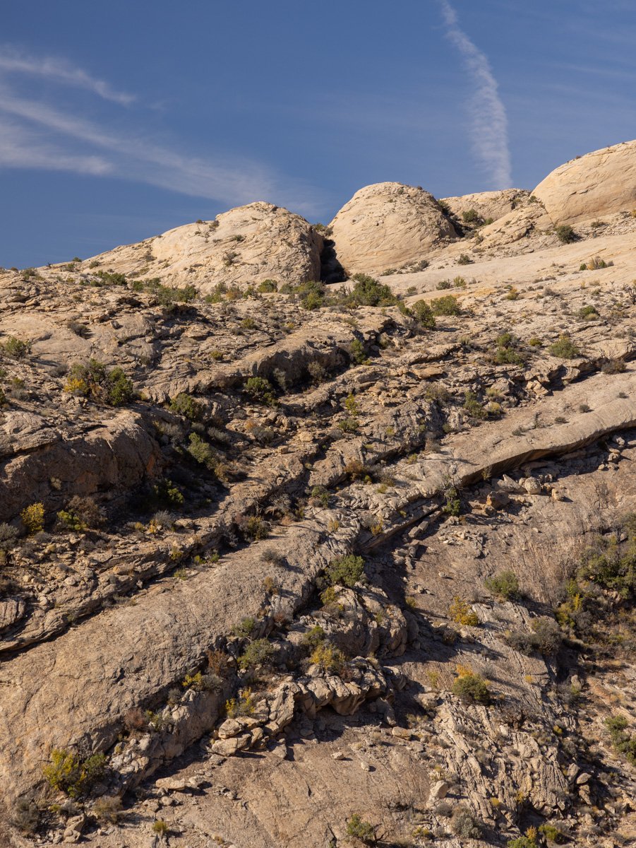
Slick Rock on Navajo Sandstone
After crossing the wash, you start the incline up the exposed sandstone. There are no trails here, so it’s best to download a map to follow on GPS. I got a new mapping app for this this trip called Gaia that is a terrific resource. Can you find Chance exploring on the slickrock? We got started too late to get up on the ridge to find the old houses that were there, so it was time to get back to camp to sleep, and head to the Big Crane in the morning.

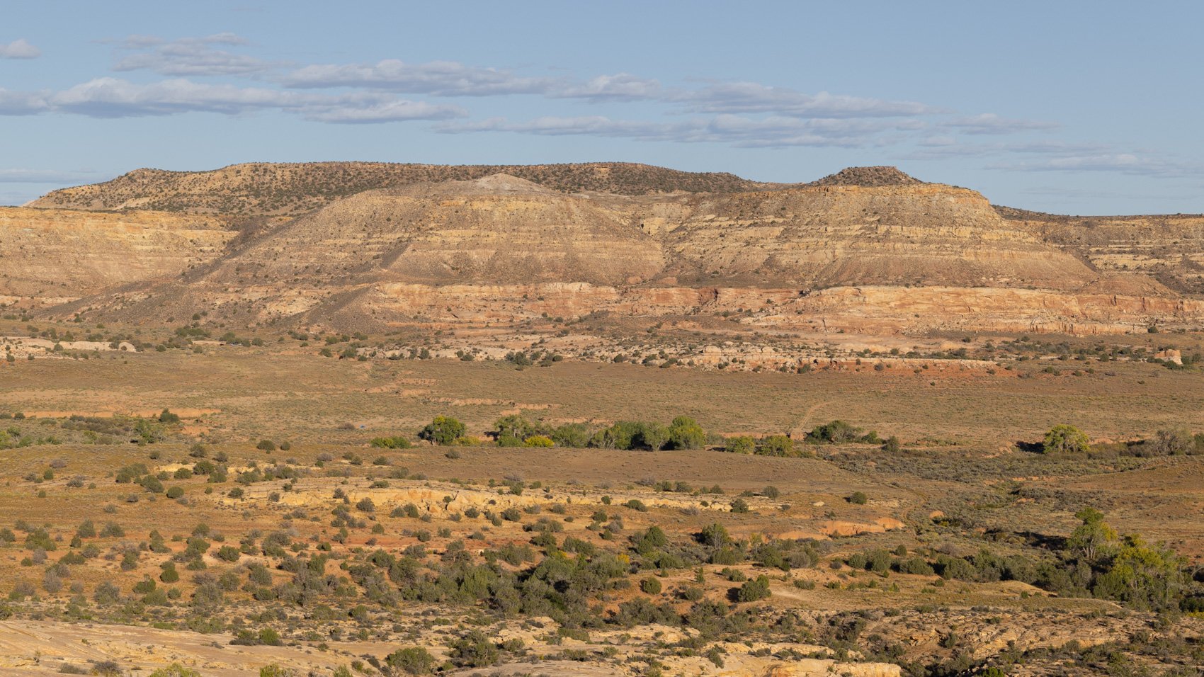
Comb Ridge
Driving down Butler Wash road in the morning to get to the Big Crane trailhead, it was clear that many other folks had the same idea that Comb Ridge would be a good place to view the eclipse the next day. But today, we’d see if we could find the crane, and scope out places to potentially get images for the eclipse the next day. In the image above, you can see how the ridge got named like the combs on a rooster’s head. Similar features extend the nearly entire length and inside many of the draws were homes of the ancestral Puebloans.

Big Crane Petroglyph
You may be able to get a sense from this why many can’t find the crane when they hike here. As I noted, there are no trails, and certainly no signs saying, “look up here.” The life-size crane image is up the cliff side, so you could easily walk by it. It certainly looks the same style as the cranes on the Wolfman panel. Did the same person make them?

Amazingly, as I write this, I hear cranes flying south. The western ones were leaving a bit earlier and I was able to see several hundred at different times on this trip. Chance found a little shady alcove to rest in, while I sat under the crane and enjoyed the view. I could see other hikers coming up. Some to visit the crane, others moving further up the ridge for the view on the edge of the monocline.
Whoever created this image, perhaps 1,200 years ago, still starts conversations. I asked some people what they thought the circle was. One person said it was an egg. Another said it was the signature of the shaman who created the image.
I trust the idea Craig Childs offered in his book Tracing Time that I re-read during the trip. He shared something he was told about spirals and concentric circles by Aaron O’Brien at other sites. O’Brien showed him a sunrise picture he took on the equinox. The sun rose directly behind a rock tower miles away “like a needle piercing the yolk of a boiling egg.” Directly behind O’Brien “was the pictograph of a hematite bull’s-eye . . . a geometric stamp, perfect, singular symmetry. Stand here, it said. This concentric-circle pictograph was on a ledge along a red-faced cliff, canyon bottom dropping away below. Someone a thousand years ago climbed with pecking tools and left one circle within another. The rock tower it denominates is miles off, too far away to cast a shadow on the wall. The way to see the alignment is to turn away from the petroglyph and watch. It says: This is one of those places.”
Craig Childs, Tracing Time, p 45.

I put my back to the wall with the bulls-eye directly above on the red-faced cliff. The canyon bottom dropped away below. Straight south, not a degree off, perhaps a mile away, two melon-shaped hills joined together. And I wondered, on the summer solstice, does the sun cross over between those hills? Does the Milky Way pour into the valley at that point? This is one of those places.
We stayed a bit longer, then returned to the car, drove down the wash to find another canyon cut into Comb Ridge to search for Procession Panel

Procession Panel “trail”
Scanning the cliffs while hiking up the ridge, a few petroglyphs are carved into an alcove here and there. Then you are face-to-face with the Procession.

Procession Panel Petroglyphs
Just ahead of these elk is a circle, and three lines of human-like figures are all marching to the circle from different directions. They are joined with many animals, snakes, dinosaur-like creatures, and horse-headed humans. Someone counted 179 people in the three processions. Was it a great gathering, a hunt, a migration? And what is the figure standing on top of five fingered animals?

We cannot know today what was in the mind of the Basketmaker Era people who carved this into the rock. But we can stand with them a few moments and wonder. And then leave to find more.